Ya’axché is committed to making decisions rooted in good science. In 2006, Ya’axché’s Science program was established to strengthen the organization’s Protected Areas Management program and Community Outreach and Livelihood program work.
RESEARCH
We must identify & understand changes in forest, river, and wildlife health
SCIENCE-BASED DECISIONS
Effective protected area management, inclusive of compliance, is dependent on useful and accurate scientific information. Achieving compliance and well managed wild places and protected areas while supporting sustainable agricultural practices requires a solid foundation of data. We have been constantly improving the monitoring and research of indicators which can tell us whether we are making progress in conserving the integrity of the Maya Golden Landscape (MGL) and improving livelihoods.
RESEARCH METHODS
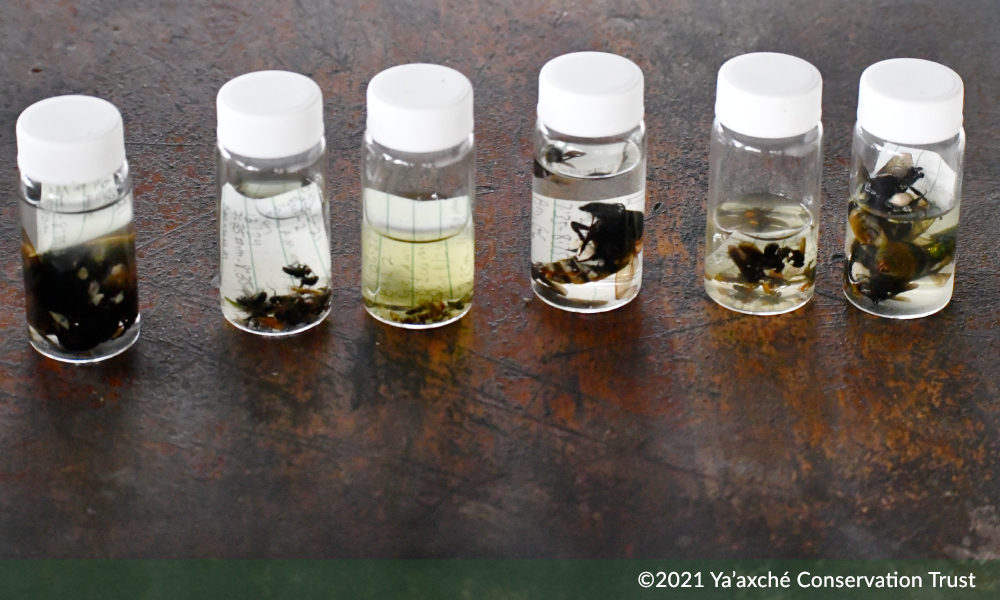
Our rangers collect data on large mammals, birds, native bees, trees, water quality and rainfall and climatic data at several points in the MGL, through monthly monitoring of twelve transects, camera surveys, and other methods within protected areas and agroforestry farms.
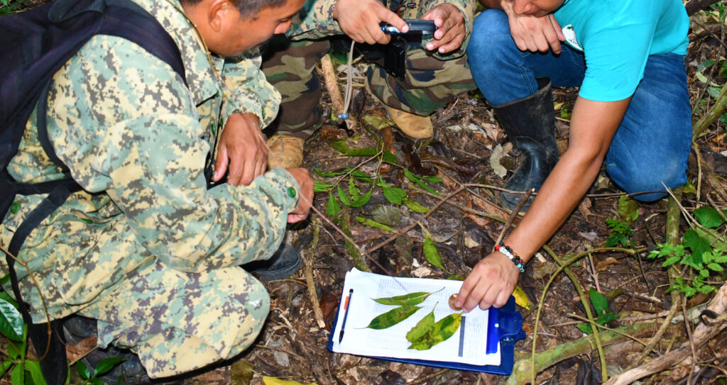
The team also collects data on four permanent vegetation plots in the diverse forest of the Bladen Nature Reserve that are monitored every five years for changes in species composition and forest structure.
The data collected on the transects are targeted with only a small number of indicator bird and mammal species highlighted as important for both conservation and management of populations and habitat. The result of this monitoring allows Ya’axché to employ a science-based approach to conservation and sustainable development, ensuring that its decisions are sound.
Our research projects


OUR RESULTS
Our research helps us determine the overall health of the environment within the MGL. The data collected is analyzed annually and presented in the State of the Park report. An example of data analysis is the comparison of bird and mammal species abundance within transects that are spread across three different landscape categories. Any major change in abundance, such as a decline, can be addressed by identifying the potential cause and implementing an appropriate conservation action such as community education and outreach, improving farming methods, building capacity, strengthening compliance, or advocating for better policies.
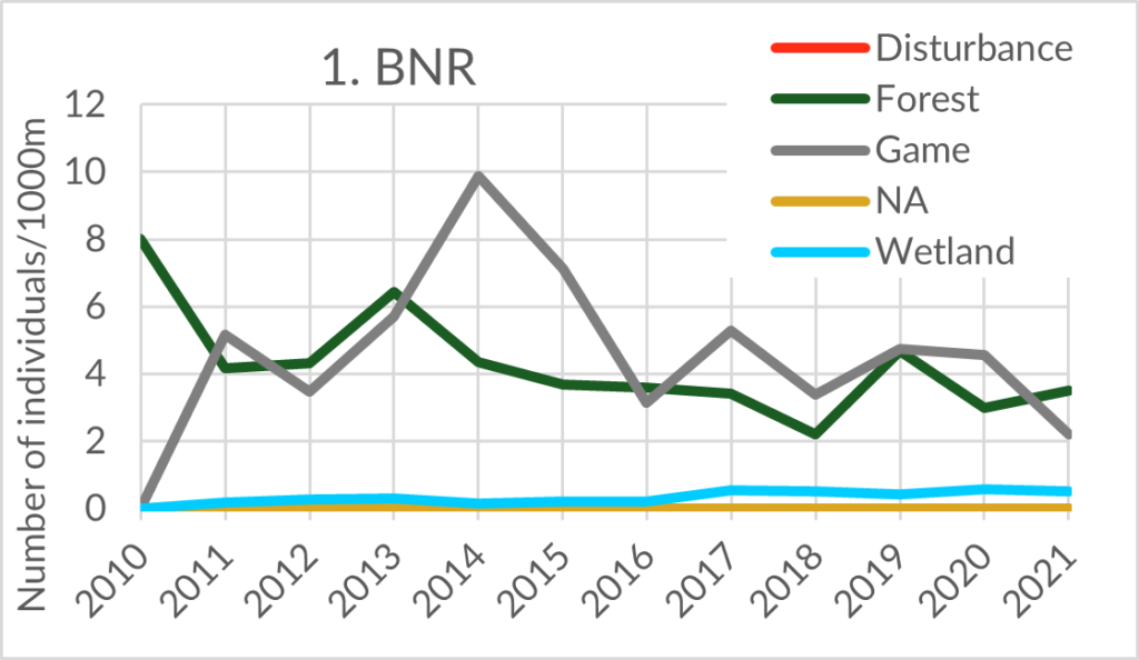
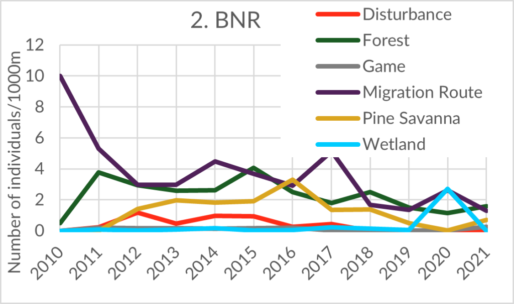
Indicator groups are considered when analyzing bird and mammal data and are used to facilitate making conclusions from the monitoring results. For example, an increase of “Disturbed Forest indicators” could indicate habitat degradation, whereas decreased “Game species” richness could indicate a high level of hunting pressure and/or habitat degradation.
DOWNLOAD OUR REPORTS
For more resources go to the downloads section of our website.
ARE YOU A RESEARCHER?
We welcome individuals or organizations that are interested in pursuing applied conservation and ecological research within the protected areas that we manage.